Satellite-derived soil moisture products are evaluated against ground-based reference measurements to quantify accuracy, temporal stability, and spatial consistency. Spire’s soil moisture datasets have been validated using established in-situ monitoring networks, including COSMOS-UK, TERENO (Germany), and the USCRN. These networks provide high-quality observations across a wide range of climates, vegetation regimes, and soil types.
Validation analyses include both spatial and temporal assessments. Spatial comparisons are used to verify large-scale geographic patterns, while station-level time series comparisons evaluate the ability of the product to capture short-term variability and seasonal dynamics. Across networks and environmental conditions, results show strong agreement between satellite-derived estimates and ground measurements, supporting the use of the datasets for operational monitoring and scientific applications.
Because soil moisture is highly influenced by local factors such as land cover, soil properties, topography, and precipitation history, validation across multiple independent networks is essential for demonstrating robustness at regional to global scales.
An example of station-level validation is shown in Figure 1, which compares Spire’s product with in-situ observations at a COSMOS-UK site.
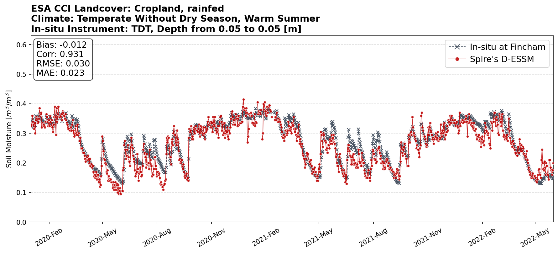
Figure 1:Comparison of Spire’s 500-m soil moisture product (D-ESSM) with in-situ measurements at the Fincham COSMOS-UK station (United Kingdom), January 2020–June 2022.
Further details:
Additional validation results and figures are available in the following article:
Validating Spire’s Soil Moisture Product — A Preview of the Data Behind the Insights